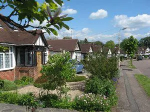
The Royds Conservation Area was designated in 2000 and covers all of the houses in Oakroyd and Elmroyd Avenue and Close, as well as Nos. 48-86 and 53-63 Baker Street, as shown on the map below.
- Map of The Royds Conservation Areapdf file[270KB]
(PDF 269kb)
A
- Conservation Area Appraisal for the Royds Estatepdf file[1.31MB]
(PDF 1.31mb) was started in 2012 and completed in October 2014.
Read the
- Royds Estate Conservation Area Design Guidepdf file[3.4MB]
(October 2014) (PDF 3.48kb)
Please note: planning applications required by an Article 4 Direction (as indicated on Page 40 of the Royds Design Guidance) were previously exempt from planning application fees. On 17 January 2018 the Governments removed this exemption and a fee is now payable for such applications.
Article 4 Direction
An Article 4 Direction was confirmed in July 2015. The Direction can be viewed below:
- The Royds Article 4 Directionpdf file[459KB]
including plan (PDF 458kb)
